


CartoDruid - GIS offline tool
توضیحات CartoDruid - GIS offline tool
CartoDruid یک برنامه GIS است که توسط Instituto Tecnológico Agrario de Castilla y León (ITACyL) توسعه یافته و به عنوان ابزاری برای پشتیبانی از کار میدانی طراحی شده است. چالش ویرایش آفلاین اطلاعات جغرافیایی ارجاع داده شده را برطرف می کند.
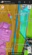
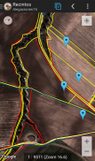
در بسیاری از مناطق میدانی با پوشش تلفن همراه ناکافی، CartoDruid با فعال کردن تجسم لایه های شطرنجی و برداری ذخیره شده در دستگاه، راه حل قابل اعتمادی را ارائه می دهد. این امکان ایجاد هندسه ها (موجودات) جدید را با رسم مستقیم آنها بر روی صفحه یا با استفاده از GPS تعبیه شده یا خارجی فراهم می کند.
CartoDruid کاربر پسند است و به دانش قبلی GIS نیاز ندارد، پیکربندی و استفاده از آن را برای هر کسی که اطلاعات کار میدانی را مدیریت می کند آسان می کند. داده های تولید شده را می توان برای استفاده در برنامه های خارجی صادر کرد.
ویژگی های CartoDruid عبارتند از:
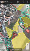
تجسم نقشه های آنلاین گوگل.
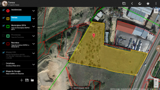
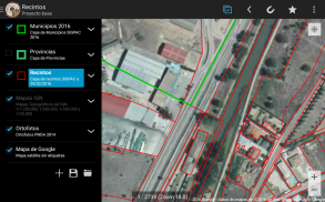
استفاده از نقشه برداری برداری در پایگاه داده SpatiaLite.
پشتیبانی از تصاویر شطرنجی از پایگاه داده RasterLite.
مصرف آنلاین خدمات WMS.
ایجاد و پیکربندی لایه های جدید روی دستگاه.
فیلتر کردن، نمادها، برچسبگذاری، جستجو و فرمهای شناسایی بر اساس پرس و جوهای SQL.
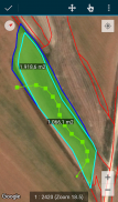
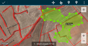
ویرایش ویژگی ها و ترسیم دستی هندسه ها.
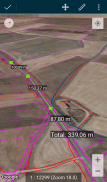
طراحی و ویرایش هندسه مبتنی بر GPS.
ابزارهای پیشرفته ویرایش هندسه
ویژگیهای ذخیرهسازی داده، از جمله دادههای ارجاعشده جغرافیایی و مرتبط کردن تصاویر به موجودیتها.
ابزارهای اضافی مانند جستجوی SIGPAC، ابزارهای اندازه گیری، کمک های ناوبری، مدیریت نشانک ها.
واردات و صادرات قابلیت ها در قالب های مختلف.
مدیریت TOC و پشتیبانی از فایل SHP به عنوان یک ویژگی آزمایشی.
کنترل های عملیات لایه
CartoDruid از خدمات مکان یابی پس زمینه برای ایجاد ویژگی هایی بر اساس ردیابی موقعیت استفاده می کند. مکان کاربر فقط برای ایجاد رئوس هندسی یا موقعیتیابی نقشه، با دادههایی که به صورت محلی ذخیره میشوند و به خارج از دستگاه ارسال نمیشوند، استفاده میشود. حذف پوشه پروژه امکان حذف آسان داده ها را فراهم می کند.
برای فهرست کاملی از ویژگیها، نمونههای قابل دانلود و راهنمای شروع، از www.cartodruid.es دیدن کنید.
CartoDruid - GIS offline tool - نسخه 0.63.2
(29-05-2025)CartoDruid - GIS offline tool - اطلاعات APK
نسخه APK: 0.63.2حزمة: es.jcyl.ita.crtdrdآخرین نسخه CartoDruid - GIS offline tool
سایر نسخهها


 3.98
3.98اپلیکیشنها در دسته مشابه

شاید دوست داشته باشید...


